Data from other layers
There are several cases where you might want to use the Scan/US "Data from other layers.." command, which is found on the Scan/US Data menu.
- Since it's possible to create a custom polygon and not summarize data to it, if you want to see demographics on your polygon, you will have to re-summarize it later on.
- Although you have specified that data be summarized to the polygon, for some reason when you return to Scan/US the next day, when you restart the program the demographics do not appear on your polygon.
- The 'default' layer for the data source is Scan/US MicroGrids, but you would like to summarize some other data to your polygon, that you have loaded onto Block Groups.
- You have loaded a point layer, and want to summarize it to standard Census geography, such as States, Counties, Tracts, Block groups.
Create Layer - Polygons
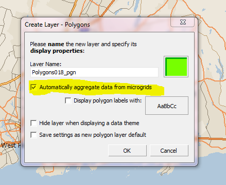
Here is what the dialog box looks like when you create a layer that does summarize data from microgrids:

Summarizing from MicroGrids (highlighted in yellow)
Normally, you have checked 'automatic' aggregation to be turned on, as above, and you do not have to specify a layer to use as a data source. When you do have to, it's good to know that it's possible.
Specifying a layer to use as a data source.
If you need to add data to your polygons later on, you can do it by following these steps:
- With your polygon layer active, from the Data Menu, choose "Data from other layers.."
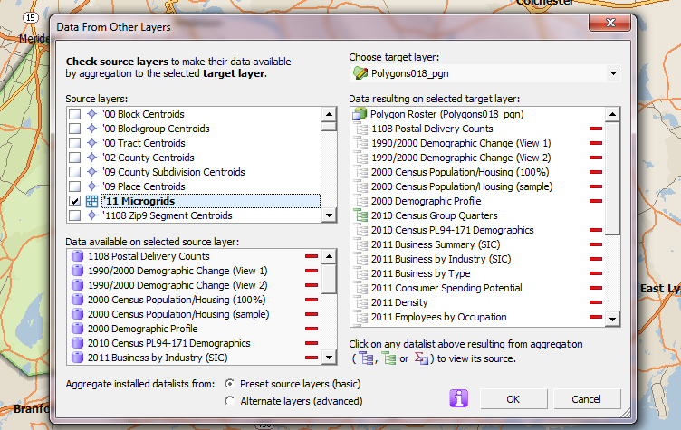
- Check off the '11 Microgrids from the "Source Layers" side (the left side) of the "Data From Other Layers" Dialog box, as below.
- Click ok.

Data from other layers (MicroGrids as source layer)
The data should be created for your shape. At this point you should be able to use the Export Data function, by choosing "Export Data.." from the Scan/US Data menu.
The other two lists shown above are read-only.
The "data available on selected source layer, at bottom left of the dialog above, shows the databases from the MicroGrids layer." The right-hand list, "Data resulting on selected target layer", shows the databases that result from the MG aggregation (i.e. the summary process), plus any databases that already exist there."
Always choose "Preset source layer (basic)." Don't use "Alternate layers (advanced)" unless you know what you are doing.
Load a point layer, summarize to Census geography.
In this example, we will load the Public Schools location file, and connect it to the County layer, using the "Data from other layers.." command.
With your geography layer active, choose "Data from other layers.." from the Data Menu.

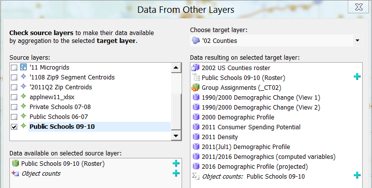
Data from other layers (Schools as source layer)
- Check off your imported point layer from the "Source Layers" side of the "Data From Other Layers" Dialog box, as above.
- Click ok. If your layer has many points, you may see a box pop up while the cross-reference is building.

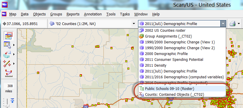
Public schools datalist shown on counties layer
After you have activated "data from other layers", you will see the data on the new layer, as shown above: All the count variables will be accessible on the Counties '02 layer in the "Public Schools 09-10 Roster" database (red circle above), and the count of schools will be available in the "Counts: Contained Objects (_CT02).
Now you will be able to make your thematic map or "heat map" of students by county.
The data will also be available for export, using "Export data..." on the Scan/US data menu.
If you wish to remove the connection of the public schools to the counties, layer, return to "Data from other layers" and un-check the box.